Home › Explainers › Density altitude, explained
In: what density altitude is (pressure altitude corrected for nonstandard temperature; the airplane performs as if it were at that altitude); what raises it (high elevation, heat, humidity and low pressure); what it does to the airplane (less power, thrust and lift, so a longer takeoff roll and a shallower climb, flown at the usual indicated airspeeds but a higher true airspeed and groundspeed); how you work it out (pressure altitude from the altimeter setting, then the temperature, on a chart or a flight computer, through the handbook's own worked example); and what you do on a hot, high day (takeoff distance and climb from the airplane's charts, a margin, then less weight, the cool of the morning or a longer runway when it does not fit, and lifting off at the normal indicated speed). Out: reading takeoff and landing charts step by step (its own topic), turbocharging, and mountain flying technique. The 2026-09-11 single on the same subject (perf-density-altitude, headline 'Thin air lengthens your takeoff and flattens your climb.') is linked from the page, and no slide uses its headline.
What the picture shows
The labels on the illustration, and what each one is pointing at.
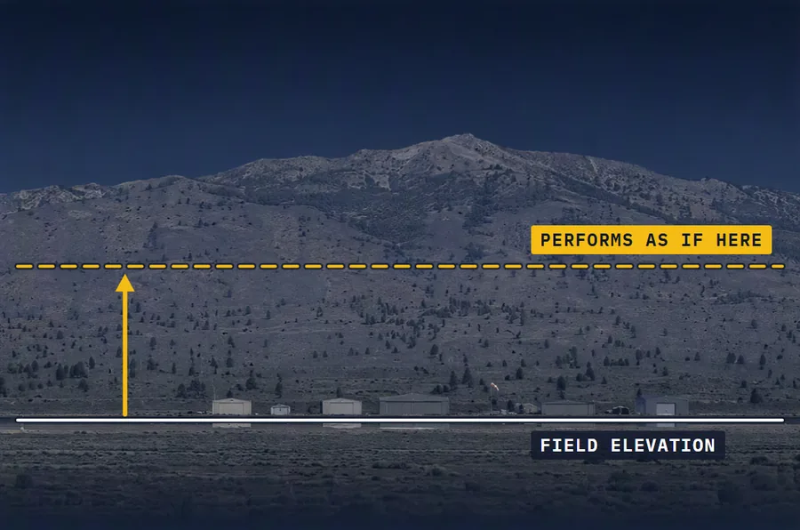
- FIELD ELEVATIONThe same airfield seen square on from the side under a mountain face: a white line marks the field's elevation along the runway, and a dashed amber line higher up marks the level the airplane performs as if it were at, with an arrow up from one to the other.
- PERFORMS AS IF HEREThe same airfield seen square on from the side under a mountain face: a white line marks the field's elevation along the runway, and a dashed amber line higher up marks the level the airplane performs as if it were at, with an arrow up from one to the other.
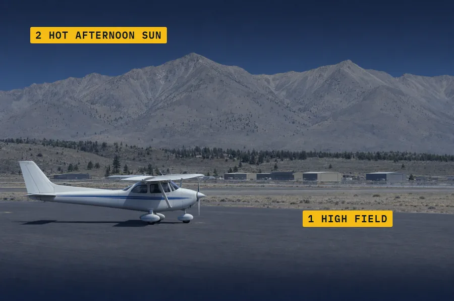
- 1 HIGH FIELDThe high valley airfield in hard afternoon light: the house Cessna 172 on the ramp casts a short shadow beneath it, with bare, dry, hazy peaks behind.
- 2 HOT AFTERNOON SUNThe high valley airfield in hard afternoon light: the house Cessna 172 on the ramp casts a short shadow beneath it, with bare, dry, hazy peaks behind.
- LOW DENSITY ALTITUDEThe runway seen square on from the side, with rising pine-covered ground beyond its far end. Two takeoff paths are drawn on it: a dashed white one that leaves the runway early and climbs steeply, with a faint ghost of the house Cessna 172 on it (low density altitude), and an amber one that leaves the runway further along and climbs at a shallower angle, with the solid house Cessna 172 on it (high density altitude). An amber bracket under the runway marks the extra roll between the two lift-off points.
- HIGH DENSITY ALTITUDEThe runway seen square on from the side, with rising pine-covered ground beyond its far end. Two takeoff paths are drawn on it: a dashed white one that leaves the runway early and climbs steeply, with a faint ghost of the house Cessna 172 on it (low density altitude), and an amber one that leaves the runway further along and climbs at a shallower angle, with the solid house Cessna 172 on it (high density altitude). An amber bracket under the runway marks the extra roll between the two lift-off points.
- EXTRA ROLLThe runway seen square on from the side, with rising pine-covered ground beyond its far end. Two takeoff paths are drawn on it: a dashed white one that leaves the runway early and climbs steeply, with a faint ghost of the house Cessna 172 on it (low density altitude), and an amber one that leaves the runway further along and climbs at a shallower angle, with the solid house Cessna 172 on it (high density altitude). An amber bracket under the runway marks the extra roll between the two lift-off points.
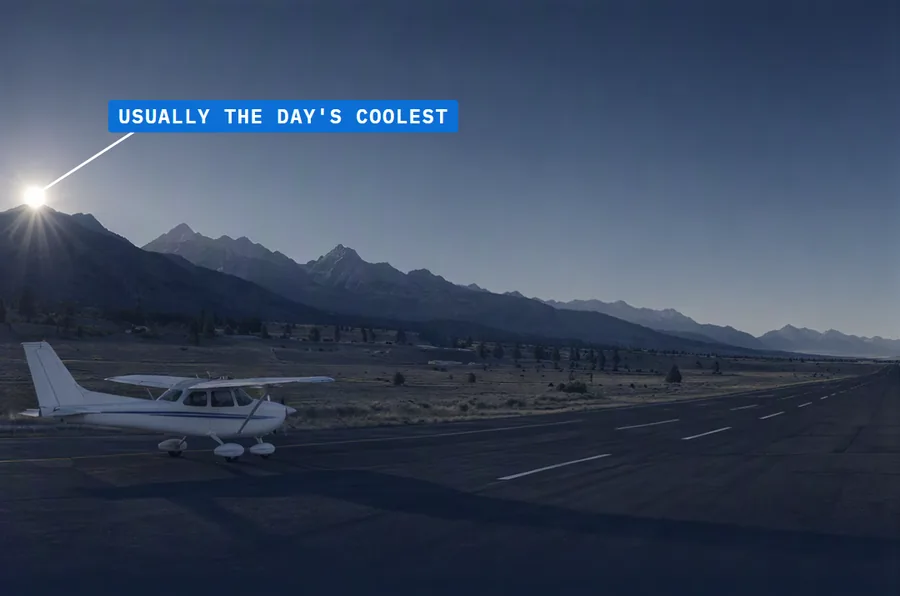
- USUALLY THE DAY'S COOLESTThe same airfield just after sunrise, in cool early light with long shadows: the house Cessna 172 waits on the runway, the sun just clearing the peaks.
The short version
Density altitude is pressure altitude corrected for nonstandard temperature: the height in the standard atmosphere where today's air density would be found. Your airplane performs as if it were there, whatever its real altitude. It is a measure of air density, not a height to fly by. High elevation, heat, humidity and low pressure all raise it. A high density altitude means a longer takeoff and landing roll and a weaker climb.
What raises it
High elevations, low pressure, high temperatures and high humidity all raise density altitude. Lower elevations, high pressure, low temperatures and low humidity point to a low one.
Temperature is the most important of the weather factors. Hot days make the air less dense, and cold days make it denser. Low pressure thins the air too, so an altimeter setting below 29.92 inches pushes density altitude up.
Humidity is a smaller factor. Water vapor is lighter than air, so moist air is less dense than dry air. In the handbook's example, at 8,000 feet with a temperature of 80° and a dew point of 75°, the density altitude is 11,564 feet. With no humidity it would be almost 500 feet lower.
What it does to the airplane
Thin air takes power from the engine, because the engine takes in less air. It takes thrust from the propeller and lift from the wing.
You can't detect the effect on the airspeed indicator. You lift off, climb and land at the usual indicated airspeeds, but your true airspeed and groundspeed are higher. So you need more runway to get airborne, and the lost power and thrust add still more. At a given indicated airspeed you climb at a shallower angle, and the landing roll is longer too.
Take an average small airplane that needs 1,000 feet to take off at sea level on a standard day. At an operational altitude of 5,000 feet, it needs about 2,000.
Working it out
First find pressure altitude. Set the altimeter to 29.92 inches and read it, correct the field elevation for the reported altimeter setting, or use a flight computer. Then correct it for temperature with a density altitude chart or a flight computer.
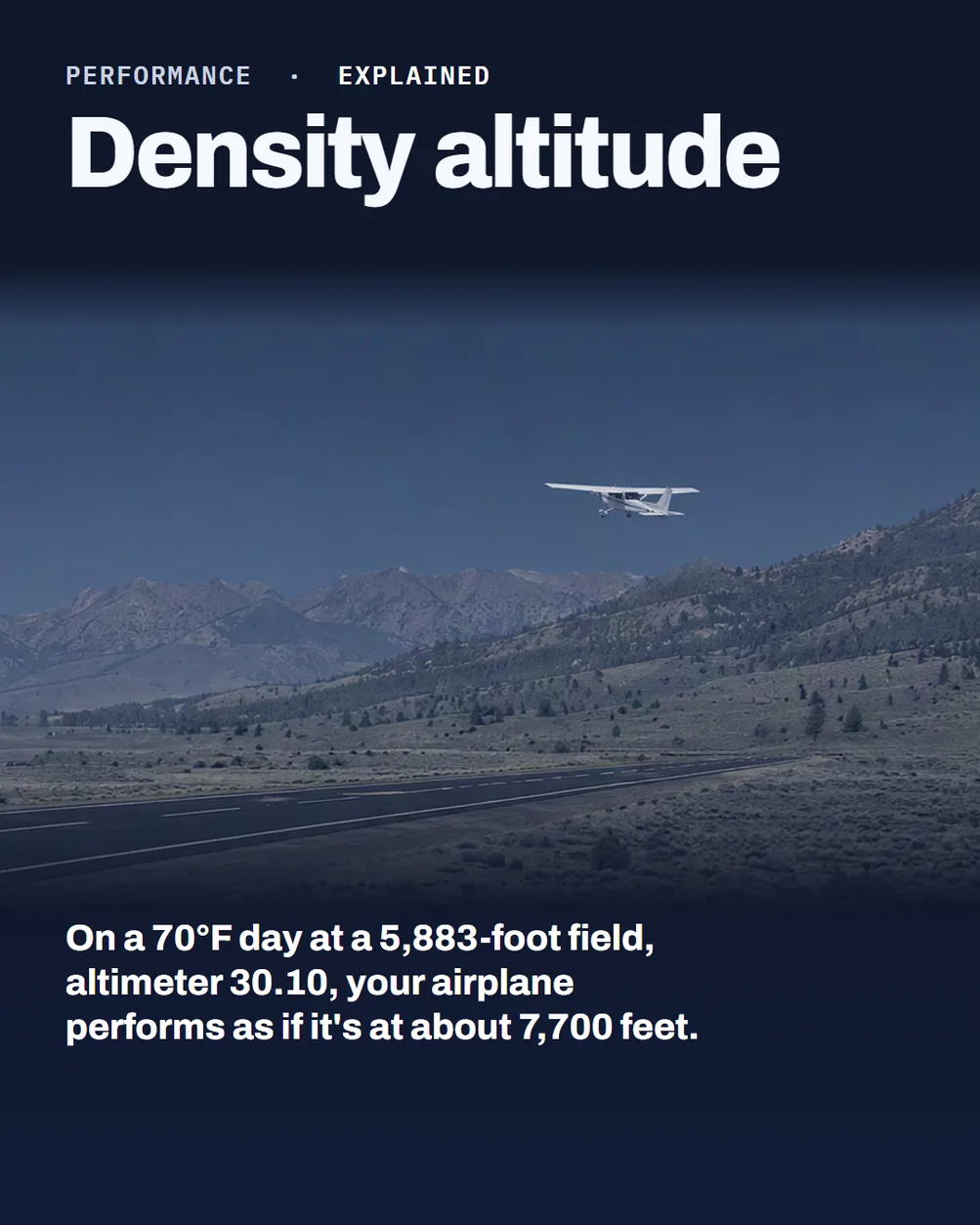
In the handbook's chart example, the airport elevation is 5,883 feet and the altimeter setting is 30.10 inches. The conversion column reads minus 165, so the pressure altitude is 5,718 feet. At 70°F, the chart gives about 7,700 feet.
At airports 2,000 feet and higher, towers and flight service stations broadcast "Check density altitude" when the temperature climbs. Working it out is still part of your own preflight.
Three mistakes on a hot, high day
Run the numbers before you decide. Take the takeoff distance and climb from your POH whatever the runway length, then add a margin. Read the charts at the real pressure altitude and temperature, with your weight and today's wind. Allow for the runway's slope and surface too. Being certified for a maximum gross weight doesn't mean you can take off at it today.
Change the plan when the numbers don't fit. Take less weight, use a longer runway or go when it's cooler. The day's lowest temperature usually comes shortly after sunrise, and the highest in the midafternoon. If none of that is enough, don't go.
Lift off at the recommended speed, not before it. Below that speed the airplane could stall, be hard to control or climb very slowly. Lean as your POH says. The handbook's sample takeoff chart, for one airplane, leans for maximum rpm in a full-throttle static runup before takeoff from fields above 3,000 feet.
Check yourself
1. Density altitude is pressure altitude corrected for what?
2. Which weather factor matters most to density altitude?
3. Why does a high density altitude lengthen the takeoff roll when you still lift off at the usual indicated airspeed?
4. Your takeoff distance is 4,700 feet, you add a 20 percent margin and the runway is 5,000 feet, so do you go?
Answers
1. Nonstandard temperature, once you have the pressure altitude.
2. Temperature, because hot days make the air less dense.
3. Your true airspeed and groundspeed are higher at that indicated airspeed, and the engine and propeller give you less power and thrust to reach it.
4. Not like that, because 4,700 feet plus 20 percent is 5,640 feet. Take less weight, use a longer runway or wait for cooler air, and if it still doesn't fit, don't go.
What this teaches
- Density altitude is pressure altitude corrected for nonstandard temperature. It is the vertical distance above sea level in the standard atmosphere at which a given density is to be found.
- Under standard conditions, pressure altitude and density altitude identify the same level. Regardless of the actual altitude at which the aircraft is operating, it will perform as though it were operating at an altitude equal to the existing density altitude.
- Density altitude is a measure of air density. It is not to be confused with pressure altitude, true altitude, or absolute altitude, and it is not to be used as a height reference, but as a determining criteria in the performance capability of an aircraft.
- The conditions that result in a high density altitude are high elevations, low atmospheric pressures, high temperatures, high humidity, or some combination of these factors. Lower elevations, high atmospheric pressure, low temperatures, and low humidity are more indicative of low density altitude.
- Density is directly proportional to pressure: if the pressure is lowered, the density is lowered (at a constant temperature). Increasing the temperature decreases the density (at a constant pressure). Pilots can expect the density to decrease with altitude.
- Temperature is the most important factor, since temperature has the greatest effect on density horizontally in the atmosphere. On hot days, the air becomes less dense, causing high density altitudes; on cold days, the air is denser, causing lower density altitudes.
- Water vapor is lighter than air, so moist air is lighter than dry air: as the water content of the air increases, the air becomes less dense, increasing density altitude and decreasing performance. Humidity alone is usually not considered an important factor in calculating density altitude and aircraft performance, but it is a contributing factor.
- In the handbook's humidity example, at 8,000 feet with a temperature of 80° and a dew point of 75°, the density altitude is 11,564 feet; with no humidity, the density altitude would be almost 500 feet lower.
- As air becomes less dense, it reduces power because the engine takes in less air, thrust because a propeller is less efficient in thin air (there is less air for the propeller to work with), and lift because the thin air exerts less force on the airfoils.
- A pilot cannot detect the effect of high density altitude on the airspeed indicator. The aircraft lifts off, climbs, cruises, glides, and lands at the prescribed indicated airspeeds, but at a specified indicated airspeed, the true airspeed and groundspeed increase proportionally as density altitude becomes higher.
- High density altitude lengthens the takeoff and landing rolls and reduces the rate of climb. Before lift-off the plane must attain a faster groundspeed and needs more runway, and the reduced power and thrust add a need for still more runway; at a prescribed indicated airspeed it flies at a faster true airspeed, which means climbing at a shallower angle.
- An average small airplane requiring 1,000 feet for takeoff at sea level under standard atmospheric conditions will require a takeoff run of approximately 2,000 feet at an operational altitude of 5,000 feet.
- Density altitude is determined by first finding pressure altitude and then correcting it for nonstandard temperature. The pressure altitude can be determined by any of the three following methods: by setting the barometric scale of the altimeter to 29.92 "Hg and reading the indicated altitude, by applying a correction factor to the indicated altitude according to the reported altimeter setting, or by using a flight computer. Using a flight computer, density altitude can be computed by inputting the pressure altitude and outside air temperature; it can also be determined from a density altitude chart.
- In the handbook's density altitude chart example, an airport elevation of 5,883 feet with an altimeter setting of 30.10 "Hg reads -165 in the conversion column, so subtracting 165 feet gives a pressure altitude of 5,718 feet; at an outside air temperature of 70°F, the chart gives an approximate density altitude of 7,700 feet.
- The pilot must make an accurate prediction of takeoff distance from the performance data of the AFM/POH, regardless of the runway available. The most critical conditions of takeoff performance are the result of some combination of high gross weight, altitude, temperature, and unfavorable wind.
- Although an aircraft is certified for a specified maximum gross takeoff weight, it may not safely take off at this weight under all conditions: conditions that affect takeoff and climb performance, such as high elevations, high temperatures, and high humidity (high density altitudes), may require a reduction in weight before flight is attempted.
- Maximum surface air temperature usually occurs during the midafternoon, and minimum surface air temperature usually occurs shortly after sunrise. Advancing or delaying a departure may reduce risk likelihood, and canceling a flight is necessary if the pilot cannot mitigate risk sufficiently by other means.
- Any attempt to take off below the recommended speed means that the aircraft could stall, be difficult to control, or have a very low initial rate of climb.
- In the handbook's case study, a takeoff at maximum gross weight from Animas Air Park (elevation 6,684 feet, where July temperatures result in a high density altitude) had a calculated takeoff distance of 4,700 feet, and the pilot's 20 percent safety factor produced a desired runway length of 5,640 feet, which exceeds the available 5,000-foot runway. She reduced the departure fuel load and had her passengers board at an airport with a 9,200-foot runway instead.
- At airports with elevations of 2,000 feet and higher, control towers and FSSs broadcast the advisory "Check Density Altitude" when the temperature reaches a predetermined level; the pilot retains the responsibility to compute density altitude, when appropriate, as a part of preflight duties.
- The handbook's sample takeoff distance chart notes that prior to takeoff from fields above 3,000 feet elevation, the mixture should be leaned to give maximum rpm in a full throttle, static runup.
Where to read more
Everything above rests on these. They are the FAA's own publications, free to read.
- Pilot's Handbook of Aeronautical Knowledge (FAA-H-8083-25), Chapter 4see Chapter 4
- Pilot's Handbook of Aeronautical Knowledge (FAA-H-8083-25), Chapter 11see Chapter 11
- Aviation Weather Handbook (FAA-H-8083-28), Chapter 8see Chapter 8
- Aeronautical Information Manual, paragraph 7-6-7Aeronautical Information Manual
- Pilot's Handbook of Aeronautical Knowledge (FAA-H-8083-25), Chapter 10see Chapter 10
- Aviation Weather Handbook (FAA-H-8083-28), Chapter 7see Chapter 7
- Risk Management Handbook (FAA-H-8083-2), Chapter 4see Chapter 4
- Risk Management Handbook (FAA-H-8083-2), Chapter 5see Chapter 5
Keep reading

Score the next flight before you go
FlightDecide reads the weather, the NOTAMs, your fuel and your weight and balance for the planned window, then scores them into a go / no-go call you can check against the raw data.
Get FlightDecide on the App StoreEducational content for pilots. It is advisory only and not a substitute for an official weather briefing, your POH, or your own judgment as pilot in command (14 CFR 91.3). The sources this explainer rests on are listed above.